
Keyword
Marine Planning Regions (Australia) | Australian Antarctic
14 record(s)
Type of resources
Topics
Keywords
Contact for the resource
Provided by
Formats
Update frequencies
Status
draft
-
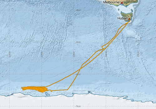
This record describes Simrad SH90 high definition omnidirectional fishery sonar, 114 kHz data collected on RV Investigator voyage IN2019_V01, titled "The availability of Antarctic krill to large predators and their role in biogeochemical recycling in the Southern Ocean" which departed Hobart on the 19th January, 2019 and returned to Hobart on the 5th of March, 2019. The Simrad SH90 provides detailed information about school density, speed, depth, heading and size, with an operational frequency of 114 kHz. The SH90 was logged sporadically to guide krill fishing, and settings were updated/changed constantly with respect to angles and frequencies in real time to point to the krill schools while trawling. Data are stored in Simrad *.raw format at CSIRO. There are 12,861 files totalling 378 GB of raw data in this dataset. The data is available "as is" without any Quality Control measures, post processing or standardized settings. Additional information regarding this dataset, including the settings used, is contained in the GSM data acquisition and processing report. Additional data products may be available on request.
-

This record describes the deep-sea sediment core products produced by Holder et al. (2020) from two sites in the Sabrina Coast continental slope and rise, the first sedimentary sequences investigated in this region of the East Antarctic. The cores were used to study changes in the oceanic and depositional environment and their interaction with the nearby Totten Glacier. The two archives show clear variations between glacial and interglacial phases over the last 350 Kyrs, driven by the movement of the ice sheet advancing and retreating over the continental shelf and ocean circulation patterns that deliver heat either close to the Antarctic coastline or further away from the continental slope. This research provided a foundation for future palaeoceanographic work in the region and suggested that warm oceanic conditions, similar to today, have influenced the Sabrina Coast during past warm interglacials over the last 350 Kyrs. For more details please refer to the cited article (download link provided below): Holder, L., M. Duffy, B. Opdyke, A. Leventer, A. Post, P. O’Brien and L. K. Armand (2020): Controls on Sedimentation and Primary Productivity in Late Pleistocene Slope Sediments Seaward of the Totten Glacier, East Antarctica. Paleoceanography, under review.
-
This record describes the Acoustic Doppler Current Profiler (ADCP) data collected from the Marine National Facility RV Investigator voyage IN2019_V01, titled: "The availability of Antarctic krill to large predators and their role in biogeochemical recycling in the Southern Ocean." The voyage took place from Hobart (TAS) to Hobart between January 19 and March 5, 2019. Voyage in2019_v01 used both active and passive acoustics for locating and mapping krill swarms. To minimise interference the ADCP equipment was turned off for most of the voyage. ADCP was active during the transits to and from the area of interest, and for brief periods during CTD casts while in the science area. Data was collected using UHDAS and post-processed using CODAS. The quality of the collected data was generally good. The University of Hawaii’s CODAS software dated 2017.10.01 was used for data post-processing. This dataset was processed and then archived within the CSIRO Oceans and Atmosphere (O&A) Information and Data Centre (IDC) in Hobart.
-
This record describes the Conductivity-Temperature-Depth (CTD) data collected from the Marine National Facility RV Investigator voyage IN2019_V01, titled: "The availability of Antarctic krill to large predators and their role in biogeochemical recycling in the Southern Ocean." The voyage took place from Hobart (TAS) to Hobart between January 19 and March 5, 2019. Data for 28 deployments were acquired using the Sea-Bird SBE911 CTD 23, fitted with 24 twelve litre bottles on the rosette sampler. CSIRO-supplied calibration factors were used to compute the pressures and preliminary conductivity values. CSIRO-supplied calibrations were applied to the temperature data. The data were subjected to automated QC to remove spikes and out-of-range values. A Wetlabs CSTAR Transmissometer, Chelsea Aquatracka III Fluorometer, Wetlabs CDOM Fluorometer, and PAR sensor were also installed on the auxiliary A/D channels of the CTD. The collected data were subsequently processed and archived within the CSIRO Oceans and Atmosphere (O&A) Information and Data Centre (IDC) in Hobart. Additional information regarding this dataset may be contained in the Voyage Summary and the CTD Data Processing Report.
-
This record describes the Conductivity-Temperature-Depth (CTD) data collected from the Marine National Facility RV Investigator voyage IN2020_V09 titled: "SOTS: Southern Ocean Time Series automated moorings for climate and carbon cycle studies southwest of Tasmania". The voyage took place between 25 August and 12 September, 2020 departing from Hobart (TAS) and arriving in Hobart (TAS). Data for 6 deployments were acquired using the Sea-Bird SBE911 CTD 25, fitted with 24 twelve litre bottles on the rosette sampler. Sea-Bird-supplied calibration factors were used to compute the pressures and preliminary conductivity values. CSIRO -supplied calibrations were applied to the temperature data. The data were subjected to automated QC to remove spikes and out-of-range values. The final conductivity calibration was based on a single deployment grouping. The final calibration from the primary sensor had a standard deviation (SD) of 0.0008174 PSU, well within our target of ‘better than 0.002 PSU’. The standard product of 1 decibar binned averaged were produced using data from the primary sensors. The dissolved oxygen data calibration fit had a SD of 0.89571 μM. The agreement between the CTD and bottle data was good. Transmissometer, Wetlabs Eco-FLBB and Altimeter were also installed on the auxiliary A/D channels of the CTD. It should be noted that the transmissometer signal below 700 decibar should be treated as suspect. A Wetlabs CSTAR Transmissometer, Chelsea Aquatracka III Fluorometer, Wetlabs CDOM Fluorometer, and PAR sensor were also installed on the auxiliary A/D channels of the CTD. The collected data were subsequently processed and archived within the CSIRO Oceans and Atmosphere (O&A) Information and Data Centre (IDC) in Hobart. Additional information regarding this dataset may be contained in the Voyage Summary and the CTD Data Processing Report.
-
This record describes the Conductivity-Temperature-Depth (CTD) data collected from the Marine National Facility RV Investigator voyage IN2017_V01 titled: "Interactions of the Totten Glacier with the Southern Ocean through multiple glacial cycles." The voyage took place from Hobart (TAS) to Hobart between the 14th January and 5th March, 2017. Data for 33 deployments were acquired during this voyage using a Seabird SBE911 CTD, fitted with 36 twelve litre bottles on the rosette sampler. Casts 1-10, 13 – 33 were acquired using the Seabird SBE911 CTD unit 20, and casts 11 and 12 were acquired using the Seabird SBE911 CTD unit 22. CTD and sensors were changed in efforts to remediate sensor issues. CSIRO -supplied calibration factors were used to compute the pressures, and preliminary temperature and conductivity values. The data were subjected to automated QC to remove spikes and out-of-range values. Processing was completed using CapPro processing software, version 2.9. For the duration of the voyage significant spikes were observed across all recorded sensor channels. Investigation strongly suggests electrical interference was the cause of the data spikes, as mitigation measures have alleviated the issue. Care was taken in post processing to remove the spikes while maintaining true data features. The nature of the spiking was primarily extreme values persisting for a single scan, which were suitably detected and flagged by evaluating the second-difference of the data. An additional filter was also applied to the data which evaluated the median and standard deviation of the conductivity over a moving window, which was used to detect extreme changes in the sensor values characteristic of the noise induced spikes. The final conductivity calibration was based on two deployment groupings, due to sensor changes during the voyage. The final calibration for casts 1-13 from the secondary sensor had a standard deviation (S.D) of 0.0010393 PSU, within our target of ‘better than 0.002 PSU’. The final calibration for casts 14-33 from the secondary sensor had a standard deviation (S.D) of 0.0020084 PSU. The standard product of 1dbar binned averaged were produced using data from the secondary sensors. The final Oxygen calibration from the primary sensor had a S.D of 0.85991 uM. The agreement between the sensor and bottle data was good. Both Oxygen sensors calibrated closely. The Biospherical photosynthetically active radiation (PAR), Wetlabs Transmissometer, the Wetlabs ECO chlorophyll, and O&A IMU sensors were also installed on the auxiliary A/D channels of the CTD. The collected data were subsequently processed and archived within the CSIRO Oceans and Atmosphere (O&A) Information and Data Centre (IDC) in Hobart. Additional information regarding this dataset may be contained in the Voyage Summary and the CTD Data Processing Report.
-
CAAB - Codes for Australian Aquatic Biota - is an 8-digit coding system for fishes and other aquatic organisms in the Australian region maintained originally by CSIRO Division of Marine Research and now CSIRO NCMI. CAAB can be used to obtain a taxon code for any species or species group on the CAAB list for use in data storage, or to obtain the current scientific name or other information for any CAAB taxon code. For groups where coverage of the Australian fauna is complete, it can also be used to generate lists of currently recognised Australian marine taxa in any genus, family or selected higher-level category. Taxon codes are useful for data storage where it is desirable to maintain the collected data (e.g. catch or survey data) independently from the associated name information (which is subject to revision or correction with changes in taxonomic knowledge). CAAB codes are also "meaningful" and convey information about the organism's classification down to the level of family, and so can be used for rapid sorting and filtering if desired. CAAB currently contains over 4,500 codes for fishes, 250+ codes for other marine vertebrates (reptiles, seabirds, and marine mammals), over 5,000 codes for marine invertebrates (including sponges, stony corals, echinoderms, commercially important crustaceans and molluscs, tunicates, and other taxa), and codes for Australian seagrasses and mangroves and a representative selection of Australian seaweeds and microalgae. While concentrating on the fauna and flora of the Australian Fishing Zone (AFZ) surrounding mainland Australia, some taxa from the broader Australasian region are also included, as well as species imported from other countries for sale domestically. CAAB also incorporates on-line links to further sources of taxonomic information such as the Australian Faunal Directory, the international directories FishBase, AlgaeBase, the US ITIS (Integrated Taxonomic Information System) database and the World Register of Marine Species (WoRMS). Links to WoRMS are particularly useful as any public occurrence data published to the Ocean Biodiversity Information System requires a WoRMS identifier The Fisheries Research and Development Corporation (FRDC) maintains the Australian Fish Names Standard (AS 5300) and Australian Standard for Aquatic Plant Names (AS 5301) vernacular name standards. Selected images are available per taxa. In particular the application Fishmap (https://www.marine.csiro.au/data/caab/fishmap.cfm) contains search tools for images and maps of the modelled species distribution of fish species. It is an updated version of the original Fishmap hosted by Atlas of Living Australia as it is current and contains regions in the Antarctic and Australia's offshore islands of Macquarie, Lord Howe, Heard and McDonald, Norfolk, Christmas and Cocos Keeling.
-
This record describes the Underway (UWY) data collected from the Marine National Facility (MNF) RV Investigator research voyage in2017_v01, titled "Interactions of the Totten Glacier with the Southern Ocean through multiple glacial cycles." The voyage took place from Hobart (TAS) to Hobart between the 14th January and 5th March, 2017. Standard Underway data is continuously recorded, it consists of: (1) NAV: Navigation data: (dual GPS) Latitude, Longitude, Speed, Heading, course over ground, Gyros, and Doppler Log. (2) TSG: Thermosalinograph: Water Salinity, flow-rate, Temperature, Fluorescence, and pCO2. (3) MET: Atmospheric (port and starboard): Humidity, Wind speed and direction (vane and ultrasonic), Radiometer, Pyranometer, PAR, Air temperature, Air pressure, Rain, Ozone and Trace gases. Data are recorded at 5 second intervals. Near real-time data is available via the link below. This dataset will be processed and archived within the CSIRO Oceans & Atmosphere Data Centre in Hobart. Data is available in 5sec intervals in NetCDF, 10 sec and 5 min intervals in ascii format. Additional information regarding this dataset is contained in the cruise report for this voyage and/or the data processing report.
-
This record describes Hydrology (HYD) data collected from the Marine National Facility (MNF) RV Investigator voyage IN2024_V01, titled: "Multidisciplinary Investigations of the Southern Ocean (MISO): Linking Physics, Biochemistry, Plankton, Aerosols, Clouds and Climate." The voyage took place between January 02, 2024 and March 05, 2024 (AEST), departing from Hobart and returning to Fremantle. Hydrology samples were collected from Niskin bottles sampled at various depths during Conductivity-Temperature-Depth (CTD) deployments. Parameters analysed were salinity, dissolved oxygen, phosphate, silicate, nitrate plus nitrite and ammonium. This dataset has been processed (quality-controlled), and archived at the CSIRO National Collections and Marine Infrastructure (NCMI) Information and Data Centre (IDC) in Hobart. Additional information regarding this dataset is contained in the Voyage Report and Data Processing Report.
-
This record describes the End of Voyage (EOV) archive from the Marine National Facility (MNF) RV Investigator research voyage in2018_v01, titled "Detecting Southern Ocean change from repeat hydrography, deep Argo and trace element biogeochemistry & CAPRICORN." The voyage took place from Hobart (TAS) to Hobart between January 11 and February 22, 2018. There were two science projects in this voyage: 1) Detecting Southern Ocean change from repeat hydrography, deep Argo and trace element biogeochemistry 2) CAPRICORN (Clouds, Aerosols, Precipitation, Radiation, and Atmospheric Composition over the Southern Ocean). For further information refer to the Voyage documentation links below. Instruments used and data collected include: Regular measurements: Acoustic Doppler Current Profiler (ADCP; 75, 150 KHz ), Lowered ADCP (LADCP), Fisheries echosounder (EK60), GPS Positioning System, Doppler Velocity Log, Met station (temp, humidity, pressure, wind, rain, PIR, PSP, PAR), pCO2, Starboard and Portside Radiometers, Radon and Ozone sensors, Weather Radar, Greenhouse Gas Analysers (Aerodyne, Picarro), Air Pressure, Wind Speed and Direction sensors, Photosynthetically Active Radiation (PAR) sensor, Seawater (TSG, fluorometer, optode), Thermosalinographs, CTD, Hydrochemistry. Voyage-specific measurements: Aerosol Aerodynamic Particle sizer (APS), Aerosol Chemical Speciation Monitor (ACSM), Argo floats, Carbon, Chemical Ionisation Mass Spectrometer (CIMS), Chlorofluorocarbons/Sulfur Hexafluoride/Nitrogen Oxides (CFC SF6 Nox), Condensation Particle Counters (CPC), Cloud Condensation Nuclei counter (CCN), Continuous Plankton Recorder (CPR), Dissolved Inorganic Carbon (DIC), Disdrometer, Infrared Sea Surface Temperature Autonomous Radiometer (ISAR), Micro Rain Radar (MRR), Microwave Radiometer (MWR), Multiangle Absorption Photometer (MAAP), Nephelometer, Nutrient (NOx) autoanalyser, Proton-Transfer-Reaction Mass Spectrometry (PTR-MS), Radiosondes, Scanning Mobility Particle Sizers (SMPS), Sea-ice, Sonic Anemometer. The archive for the IN2018_V01 EOV raw data is curated by the CSIRO Oceans and Atmosphere (O&A) Information and Data Centre (IDC) in Hobart, with a permanent archive at the CSIRO Data Access Portal (DAP, https://data.csiro.au/dap/), providing access to participants and processors of the data collected in the voyage. All voyage documentation is available electronically to MNF support via the local network. Access to voyage documentation for non-CSIRO participants can be made via DataLibrariansOAMNF@csiro.au.